بسم الله الرحمن الرحيم
In the name of Allah, the Most Gracious, the Most Merciful
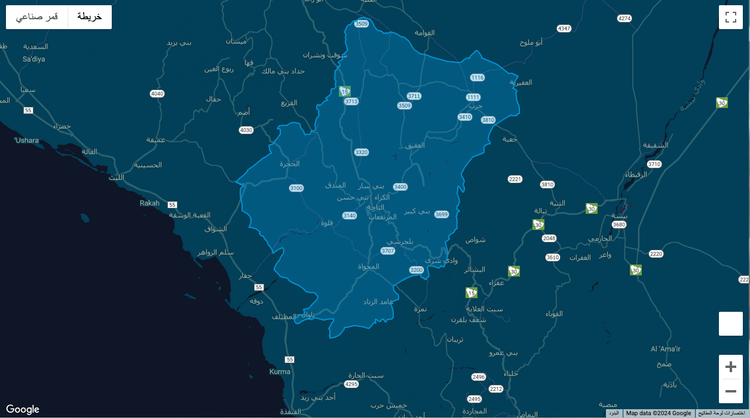
أثناء عملي في أحد المشاريع، طُلب مني إضافة overlay لمنطقة الباحة في المملكة العربية السعودية.
تذكرت أني قمت بتنفيذ نفس الطلب في مشروع آخر قبل حوالي 4 سنوات وتذكرت رحلة البحث الطويلة عن إحداثيات للحدود. وجدت ملف KML (تستخدم لعرض البيانات الجغرافية) يحتوي على الإحداثيات على موقع ويب يوفر ملفات KML لحدود الدول والمناطق، وحولت البيانات في الملف إلى خطوط طول وعرض lng/lat، ثم أضفتها إلى الخريطة overlay.
    // const contains lat/lng coordinates
    const overlayPath = [{lat:20.40994682,lng:42.11893877},{lat:20.40954332,lng:42.11729597},...];

    // Create overlay from coordinates + adding style
    const Overlay = new google.maps.Polygon({
      paths: overlayPath,
      strokeColor: "#0099dd",
      strokeOpacity: 0.9,
      strokeWeight: 2,
      fillColor: "#0099dd",
      fillOpacity: 0.3,
    });

	// Applying overlay to your map instance
    Overlay.setMap(mapInstance);